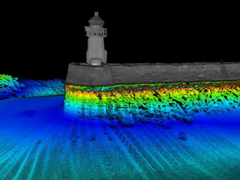
High-Resolution Multibeam
High-Resolution Multibeam or HRMB is a bathymetric survey solution that uses a multi-beam echosounder to measure the depth of water at multiple angles in order to create a detailed 3D map of the seafloor. The system uses hundreds of beams to collect data from a single point that is then used to create a precise 3D map of the seafloor. The system can be used to map shallow and deep water areas, as well as to identify precise locations of objects on the seafloor. HRMB is used by hydrographic surveyors to map out the seafloor and create detailed maps of the ocean bottom.
Importance
A high-resolution multibeam bathymetry is an important tool in hydrographic surveys. It provides accurate depth measurements and detailed seafloor information that can be used to create detailed bathymetric maps. Multibeam bathymetry is used to create detailed maps of the seafloor that can be used to assess the ocean environment, identify seafloor features, and to aid navigation. It is also used to identify hazards, measure water depth, and in navigation safety. High-resolution multibeam bathymetry is critical for hydrographic surveys as it provides the most accurate information available for bathymetric survey solutions.
Use Case
High-Resolution Multibeam in Hydrographic Surveys can be used in bathymetric survey solutions to collect detailed data from the seafloor. The collected data can be used to create accurate bathymetric maps of the seafloor. This data can then be used in a variety of applications, such as creating detailed navigation charts for ships, environmental assessments related to coastal water management, resource exploration, and development, and to a better understanding of ocean currents and sediment transport. Additionally, high-resolution multibeam data can be used to create virtual three-dimensional images of the seafloor, offering a better understanding of the topography of the seafloor and its features.